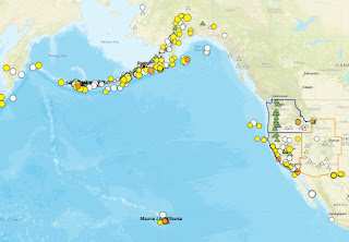
There are about 169 volcanoes in the United States that scientists consider active (source). Most of these are located in Alaska, where eruptions occur virtually every year. Others are located throughout the west and in Hawaii (Ring of Fire anyone?).
There are several ways we minimize the danger of volcanic activity (apart from the obvious of ‘getting out of the way’…(:
· Forecasting (earthquakes as early warnings -although in 2014 a Japanese volcano erupted without any previous seismicity (livescience article), land swelling before eruption, gas emissions, etc.)
· Volcanic Alert Codes (USGS): the levels of alert and the aviation code levels commonly change at the same time (chart on right). A non-erupting volcano will have a green icon, and a red one indicates an imminent eruption (see USGS Alert Codes).
Today the US hazards map (below along with registered earthquakes) shows 6 volcanoes as to be above normal background (elevated unrest):
Kilauea, Semisopochnoi, Great Sitkin, and Pavlof Alert Level=WATCH. Aviation Color Code=Orange.
Davidof, and Mauna Loa Alert Level=ADVISORY. Aviation Color Code=Yellow.

No comments:
Post a Comment